

REPORTS & PLANS

Ridge to Reefs Reports, Community Action & Watershed Management Plans


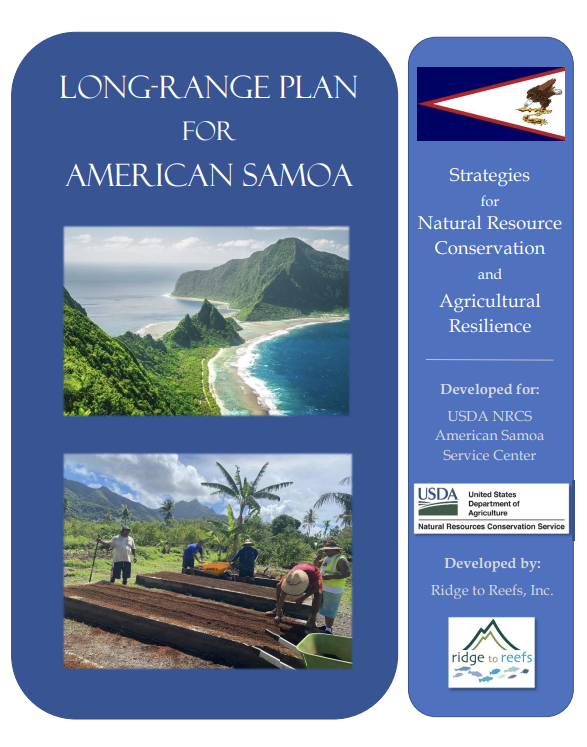
Long Range Plan for American Samoa
Strategies for Natural Resource Conservation and Agricultural Resilience
American Samoa is a unique Pacific island home to rich cultural traditions and remarkable natural beauty. Local food and water security is currently an issue facing many islands including American Samoa. Natural resource concerns that impact ecosystem health, abundant local food production and a strong agricultral economy must be addressed to ensure long-lasting resilience and elevated quality of life for American Samoans. This Long-Range Plan is intended to help guide effective allocation of the next five years (2022-2027) of NRCS funding to address priority natural resource concerns facing farmers and ranchers in American Samoa. This plan includes recommendations and input from local natural resource and agriculture experts, as well as farmers, to ensure community needs are met through NRCS programs and funding. Where NRCS programs are not applicable, other funding sources or avenues to success are recommended.

Long Range Plan for Hawai’i Island’s Hilo Service Center Area
“HE ALI’I KA ‘ĀINA; HE KAUWĀ KE KANAKA” - ‘Ōlelo No‘eau, 531
“LAND IS THE CHIEF, MAN IS THE SERVANT”
This Long- Range Plan seeks to enable and support grassroots collaborative efforts between the USDA NRCS, local organizations and experts, farmers, ranchers, landowners, students, and community members in Hawai’i Island’s Hilo Service Center Area. This plan places an intentional focus on recommending practical interventions that can be made by the relevant stakeholders to address priority resource concerns and regulatory and/or policy hurdles that may have thus far stymied more effective models of agricultural and environmental management. It is clear that the natural ecosystems in Hawai’i are under increasing pressure from threats exacerbated by invasive species and climate change. For this reason, adopting a “Climate Smart” strategy around agriculture, forestry, and natural resource management is a pressing need. This Long Range Plan provides detailed recommendations which will alleviate existing resource concerns and further the adoption of a “Climate Smart” strategy by leveraging existing USDA programs and simultaneously supporting local collaborations, education, technical assistance, and capacity building.

Guánica Bay Watershed Management Plan
A Pilot Project for Watershed Planning in Puerto Rico
This report outlines a comprehensive set of actions and an overall management strategy for improving and protecting the Guánica Bay watershed from nonpoint sources of pollution. These are derived from land use alterations in residential, commercial, and agricultural applications. This watershed plan is intended to identify a set of key recommendations, specific partners, and next steps towards implementation. Recommendations presented here address land-use and land-use change, nutrient and sediment runoff, sewage treatment, streambank stabilization, buffer improvements, and improved sediment and erosion control.
The secondary purpose of this project is to pilot a methodology for assessment and planning appropriate for local agencies to apply in other watersheds throughout Puerto Rico. The National Oceanic and Atmospheric Administration (NOAA) and Departamento De Recursos Naturales Y Ambientales will use the project to evaluate efforts required to develop a comprehensive watershed management plan based on existing studies, limited field observations, and informal meetings with local residents, scientists, farmers, developers, and agency staff

Culebra Community Watershed Action Plan for Water Quality and Coral Reefs
This watershed plan is the result of the initial watershed planning process in Culebra. The goal of the watershed plan is to chart a course for improving water quality and the health of coral reefs to serve the goals of the citizens of Culebra. The process to complete the Plan has included:
1) a baseline study summarizing existing scientific information on the study area (integrated into this report);
2) a stakeholder process including meetings with individuals, agencies, and a series of meetings with the public to establish goals and objectives for the watershed plan;
3) fieldwork to assess water quality and coral reef conditions, as well as identify the sources of land-based pollution;
4) identification and prioritization of restoration opportunities including policy changes, implementation project opportunities and enforcement issues; and
5) completion of a final watershed plan.

Guidance for Reducing the Impact of Dirt Roads on Culebra Reefs: Report August 2015
This document recommends standards for dirt road construction, maintenance, and retrofitting to minimize impacts on the nearshore marine environment. It also provides guidance for minimizing construction and maintenance costs. Dirt roads transport sediments to the coast and reduce the quality and abundance of coral reef and sea grass habitats. These are important for marine turtles, juvenile fish, and shellfish. Reducing the impacts of dirt roads protects the nearshore ecosystems, reduces their maintenance costs, and helps to protect the natural beauty, economy, and ecosystems for future generations.

Catchment Management and Coral Reef Conservation
Case Study- The Guanica Bay, Rio Loco Watershed Project in Puerto Rico (starting page 52)
The Guánica Bay/Rio Loco watershed provides drinking and irrigation water and flows to some of the most extensive coral reefs in Puerto Rico. Development has increased nutrient loads and sediment runoff. In the past 50 years, more than 50% of live coral has been lost, including more than 90% elkhorn and staghorn corals. Ridge to Reefs assessed the watershed and developed models of the catchment area. Farmers and resource managers in the community provided in-depth local knowledge of pollution sources and access to important areas. After identifying major point and non-point sources of pollution, we modeled nutrient and sediment loads and benefits of control measures to improve water quality and reduce impacts on the reef.

Creating Treatment Trains: Capturing >90% of Sediment Runoff Before Reaching Coral Reefs
Using a treatment train approach in Culebra, Puerto Rico
Reducing the downstream transportation of sediment that impacts coral reefs is a challenging task. Land uses in tropical coastal areas alter the ecosystems and can greatly increase sediment erosion. By engineering new ways to combine techniques and best management practices, Ridge to Reefs has been able to achieve high levels of sediment reduction (>90%). Importantly, we have also been able to capture and stabilize the small grained particles that suspend easily in the water column and pose a particular challenge to the health of coral reefs.

Cabo Rojo Community Watershed Action Plan for Water Quality and Coral Reefs
This watershed plan represents the culmination of the watershed planning process in Cabo Rojo. The goal of the watershed plan is to chart a course for improving water quality and the health of coral reefs, serving the goals of the citizens of the Cabo Rojo/Guanajibo watersheds. These goals include protecting public health, promoting safe and healthy beaches, and protecting natural resources which serve to support the local economy.

Culebra Community Watershed Action Plan: Report August 2015
As part of implementing the Culebra Community Watershed Action Plan for Coral Reefs and Water Quality, two projects were carried out from October to December 2014; one at Zoní Beach and the other in Downtown Culebra. These projects address impacts to Culebra's coastal and marine resources from both untreated runoff and sediment eroding from parking areas and unpaved roads. Both projects and locations were chosen with strong community participation. These projects provide protection for sensitive coral reef communities, including the Luis Peña Marine Reserve.